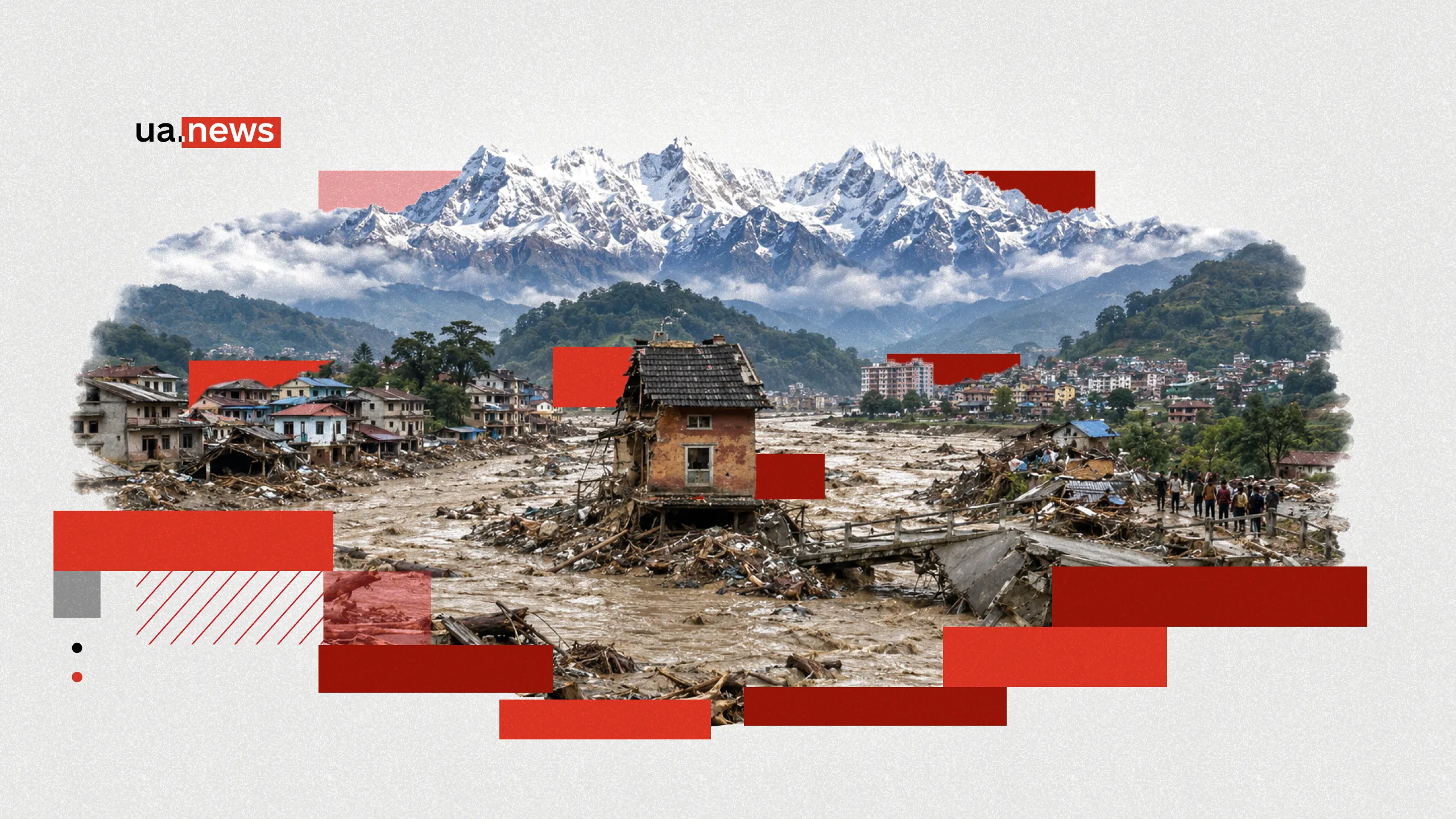
Nepal is experiencing one of the most devastating natural disasters in recent years. On August 26, a massive avalanche of ice, rocks, and soil came crashing down in the Himalayas near the border with Chinese Tibet. The debris flow raced down mountain rivers, destroying villages, roads, bridges, and power facilities. As of the morning of August 28, the confirmed death toll in Nepal had risen to 469, with more than a thousand people still missing.
Among those with whom contact has been lost following the natural disaster are Ukrainians. According to the latest data from the Ministry of Foreign Affairs, 56 Ukrainian citizens are being searched for. At the same time, there are currently no Ukrainians on the lists of confirmed fatalities or injuries. A task force from the Ukrainian Embassy is already working directly in the disaster area.
UA.News explains what happened in the Himalayas on August 26, how a glacier collapse triggered a chain reaction, why water turned mountain valleys into a torrent of rocks and mud in a matter of minutes, where Ukrainians are being searched for, and why Nepal is already facing the threat of a second flood following the first.
August 26: It all began high in the Himalayas

The disaster began in the high-altitude part of the region near the border between Nepal and Tibet. Initially, seismological stations detected a strong signal. Based on its characteristics, it might have seemed that an earthquake had occurred in the area.
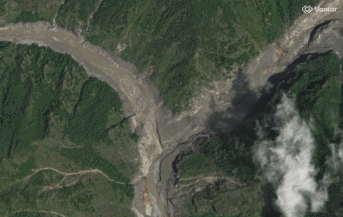
However, further analysis of satellite images revealed a different picture. According to preliminary findings by researchers cited by the Associated Press, a massive portion of a glacier broke away from the mountain range. Along with the ice, rocks, soil, and boulders began sliding downhill.
The mass was so large that the avalanche itself generated a seismic signal. This triggered a chain reaction. The debris entered a system of mountain rivers that flows toward the Rasuwa district of Nepal.
It was from there that the first images of the massive destruction began to emerge a few hours later.
It Wasn’t a Concrete Dam: What Actually Broke
One of the key questions in this story is what exactly people mean when they talk about a “dam breach.”
This does not refer to the destruction of a concrete dam. After the glacier collapsed, a massive mass of rocks, ice, and earth blocked part of the riverbed. In effect, nature itself created a dam in a short period of time.
Such formations are called natural dams. Water continued to flow down from the headwaters, but its path was blocked by a chaotic mass of debris. Water began to accumulate behind the dam.
The problem is that, unlike an engineered dam, such a structure is not reinforced in any way. It consists of boulders, soil, ice, and sand, among which the water constantly seeks out weak spots.
Under the pressure of the reservoir, the dam gradually crumbles. When a section of it gives way, a massive volume of water can be released almost instantaneously.
It is precisely this mechanism that is considered one of the main causes of the catastrophic wave that swept downstream toward Nepal.
The water flowed from Tibet through the Bhote Koshi to the Trishuli
The flood’s subsequent path can now be reconstructed with reasonable accuracy.
The floodwaters came from the direction of Tibet via the Bhote Koshi River. The flow then passed through Rasuwa Ghadhi, Timure, and Syabrubesi before reaching the Trishuli River.

Mountain rivers in this region flow through narrow valleys. Roads, bridges, settlements, power plants, and border infrastructure are built alongside them simply because there is often no other convenient place in the mountains.
When a wave several meters high suddenly enters such a valley, the water has practically nowhere to spread out. It concentrates in a single narrow corridor and continues to gain destructive force.
In half an hour, the water level could rise by about nine meters
The rapid pace of the events was one of the main reasons for the high number of casualties.
According to researchers’ estimates, in some areas the water level could have risen by about nine meters in just 30 minutes. For people downstream, this left virtually no time to react.
Even if a warning was issued, people had to figure out what was happening, locate their relatives, leave their homes, and climb high enough above the river.
But the biggest problem wasn’t even the water itself. The flood carried rocks, trees, soil, cars, and debris from buildings. At one point, it effectively turned into a mudslide.
Such a mass is much heavier than a typical flood and is capable of destroying concrete structures, washing away roads, and dislodging large boulders.
The northern regions of Nepal near the border with Tibet were hit the hardest.
The disaster caused serious damage to settlements, roads, power facilities, and border infrastructure. About a thousand passenger cars and trucks were stranded due to damaged or completely blocked roads.
For mountainous Nepal, this is a particularly serious problem. In many places, a single road is effectively the only transportation corridor between settlements.
If it is washed away, a settlement can find itself cut off from the rest of the country for days or even weeks. The same applies to bridges. The destruction of a single crossing over a mountain river sometimes means having to take a huge detour or, in some cases, leaves a helicopter as the only way to reach people.
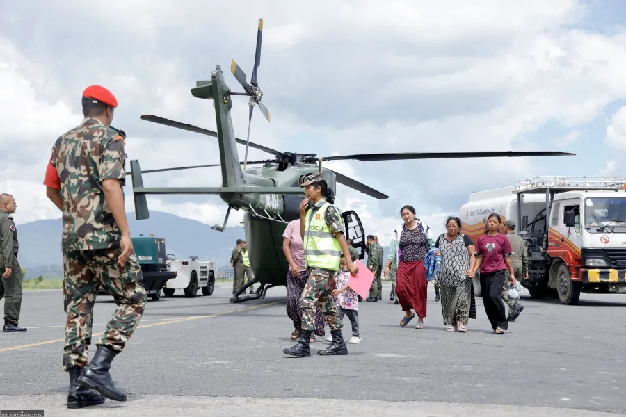
That is why aviation has become a key part of the rescue operation.
As of August 27, 239 helicopter flights had been carried out. 211 were conducted by the Nepalese Army, and another 28 by private companies.
Buses Carrying Pilgrims Have Gone Missing
After the flood, approximately 18–20 buses carrying pilgrims to Lake Goshaikunda for the Janay Purnima festival could not be located.
For some time, ground rescue teams were unable to even reach the area due to damaged roads. Under such conditions, it is extremely difficult to determine the exact number of people in the disaster zone.
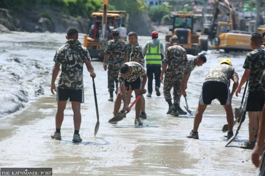
Some were traveling by bus. Others were part of tour groups. Still others may have been traveling independently between small mountain villages.
That is why, during the first two days, the figures regarding the missing were constantly changing.
Why Are There So Many Foreigners Among the Missing?
The Nepalese Himalayas are one of the world’s most popular high-altitude tourist regions. That is why hundreds of foreigners were there when the natural disaster struck.
On the morning of August 27, it was reported that 590 tourists could not be reached. Among them were 476 foreigners and 114 Nepalese citizens.
The numbers later increased. According to more recent data, over a thousand people remained on the missing persons lists, including up to 540 foreigners from more than 30 countries.
The mere fact that contact has been lost, however, does not necessarily mean that a person has died. Roads, power lines, and telecommunications infrastructure have been damaged in the affected areas. Some tourist groups may simply have been cut off from the network.
For this reason, consular services from many countries are simultaneously checking the lists maintained by hotels, tour operators, guides, and rescue centers.
56 Ukrainians remain out of contact
The Ukrainian connection to this story became clear on the very first day after the disaster. Initially, reports mentioned a single large tour group.
Later, it became known that there were two Ukrainian tourist groups: one consisted of 47 people, the other of seven. Another Ukrainian woman was traveling with foreigners.
The number subsequently increased. As of the morning of August 28, the Ministry of Foreign Affairs reported that 56 Ukrainians remained out of contact.
At the same time, the ministry specifically emphasized that there are no Ukrainians on the confirmed lists of the dead or injured. In this case, the phrase “missing” primarily means the inability to establish contact in an area where communications infrastructure has been extensively destroyed.
The search for Ukrainians is not limited to remote efforts. A task force from the Ukrainian Embassy in India has arrived directly in the disaster area.
Consuls are in contact with the Nepalese authorities and local rescue services. Ukraine’s honorary consul in Nepal has also been involved in the operation. The main task now is to determine the whereabouts of every Ukrainian citizen and, if necessary, organize their evacuation.
At the same time, search teams have been provided with all available information regarding Ukrainians—including itineraries, the composition of tourist groups, and other details that may help locate them.
August 27: The scale of the tragedy began to grow rapidly
Initial death toll figures following the disaster were significantly lower. This is a typical situation for large-scale floods in remote mountainous terrain. At first, rescue workers are physically unable to reach some of the affected areas.
As access is restored, the number of bodies found begins to rise. As of August 27, at least 165 deaths have been reported.
At that time, Nepal News had already reported 177 bodies found. Some of them have still not been identified. Bodies were found not only in Rasuwa but also in Nuwakot, Dhading, Gorkha, Chitwan, Tanahuni, and Nawalparasi.
The scale of the rescue operation also grew rapidly. By August 27, 7,415 security personnel had been deployed. Among them were 3,318 police officers, 2,355 military personnel, and 1,742 members of the Nepal Armed Police Force.
Medical teams worked alongside them. Temporary shelters were set up for the evacuees, and people were provided with drinking water, food, and medicine.
However, the effectiveness of the rescue operation depends heavily on the weather. In the mountains, even helicopters cannot always operate due to low cloud cover, rain, or unstable air currents.
As of the morning of August 28, 469 deaths had already been reported in Nepal. More than a thousand people were still listed as missing. The search has been ongoing for three days now.
Rescuers are searching riverbeds, fields of debris, destroyed buildings, and areas that were previously inaccessible. Given the scale of the disaster, the final death toll may still change.
A new dangerous lake formed after the first flood
But the story didn’t end there. After the landslide and the first flood, a massive amount of rocks and debris remained in the mountain valley. Some of it blocked the river again.
As a result, a new dammed lake formed. On August 28, reports emerged of the threat of a new flood. As of Thursday, approximately two million cubic meters of water had accumulated in the reservoir.
According to forecasts by Chinese authorities, another three million cubic meters could flow in over the next three days. For comparison, that’s roughly 1,200 Olympic-sized swimming pools.
The largest influx is expected around September 1.

The problem essentially mirrors the mechanism of the first disaster. The river was blocked not by a concrete structure, but by rocks and debris. More and more water is accumulating behind them.
The larger the body of water, the greater the pressure it exerts on the natural barrier. The Chinese side has already dispatched an engineering team to conduct an aerial survey of the area and create 3D models.
Experts are considering the possibility of constructing a drainage channel. But doing so quickly in an unstable high-mountainous area is extremely difficult. Forecasted rainfall poses an additional danger.
If the water level continues to rise rapidly, the dam may not hold. In that case, a new wave will rush down the same valley.
People are again being asked to stay away from rivers
Due to the new threat, local authorities have urged residents downstream to remain in safe areas. Rescue workers have also been advised not to work directly along the banks in dangerous areas. In fact, people who had just begun to return home after the first flood are once again forced to prepare for evacuation.
This is precisely what makes the current disaster particularly challenging. The search operation is not yet over. Hundreds of families do not know where their relatives are.
Roads and bridges need to be rebuilt. At the same time, rescue workers must prepare for a possible second wave of flooding.
Why the Himalayas Are Becoming Increasingly Dangerous
A separate question is whether the disaster can be directly linked to climate change. The causes of this specific glacier collapse still require detailed investigation.
It is necessary to determine the role of temperature, precipitation, the glacier’s structure, the condition of the rocks, and other factors. Therefore, it would be premature to say that global warming was the sole direct cause of the events of August 26.
However, the overall trend has long been a cause for concern among scientists.
As researchers quoted by the Associated Press explain, warming in the Himalayas is leading to glacial retreat and the degradation of permafrost. This affects more than just the volume of ice.
Frozen soil actually helps stabilize mountain slopes. When it thaws, rock masses become less stable. At the same time, new lakes form near the glaciers, often held back only by natural embankments.
This gives rise to a whole range of risks—from rock and ice avalanches to sudden glacial lake outbursts.
This is not an entirely new threat for the country. In August 2024, a catastrophic flood virtually destroyed the village of Thame. The water carried mud, gravel, and large boulders downstream.
Twenty houses, a school, and a medical facility were destroyed. In other words, Nepal is already familiar with this mechanism: water accumulates high in the mountains, a natural barrier collapses—and a powerful wave rushes downhill in a very short time.
But the events of August 2026 turned out to be on an incomparably larger scale.
The disaster lasted for hours, and its consequences will be felt for years
The main force of the disaster struck very quickly. A landslide. A blocked river. Accumulation of water. A breach. And a torrent that, in just a few hours, swept through dozens of kilometers of mountain valleys.
But the region’s recovery will take much longer. Nepal will have to repair roads, rebuild bridges, and restore power infrastructure, communications, and housing.
At the same time, the country will need to review its early-warning systems. A typical flood following heavy rain often develops gradually. Here, there may have been only a few dozen minutes’ warning.
And this, most likely, will be one of the main lessons learned from the tragedy.
The disaster on August 26 demonstrated that danger in the Himalayas can arise far from populated areas, high up among the glaciers, and within just a few hours turn into a humanitarian crisis for an entire country.
And while rescuers continue to search for more than a thousand people—including dozens of Ukrainians—a new threat is already taking shape in the mountains. Therefore, as of August 28, this disaster is still not over for Nepal.