
Photo: NASA showed Earth in the shape of a potato

NASA has released a visualization of Earth's gravitational field, in which the planet resembles a giant "potato" with protrusions and depressions. However, this is not the Earth’s actual shape, but a highly exaggerated model of the geoid, which reflects the unevenness of the planet’s gravitational field.
Scientists use the concept of a geoid—a mathematical model of a hypothetical sea level if it were affected only by Earth’s gravity and rotation, without accounting for tides, waves, winds, and currents.
The planet’s gravitational field is not uniform across different regions. This is due to the uneven distribution of mass both on the surface and within the Earth.
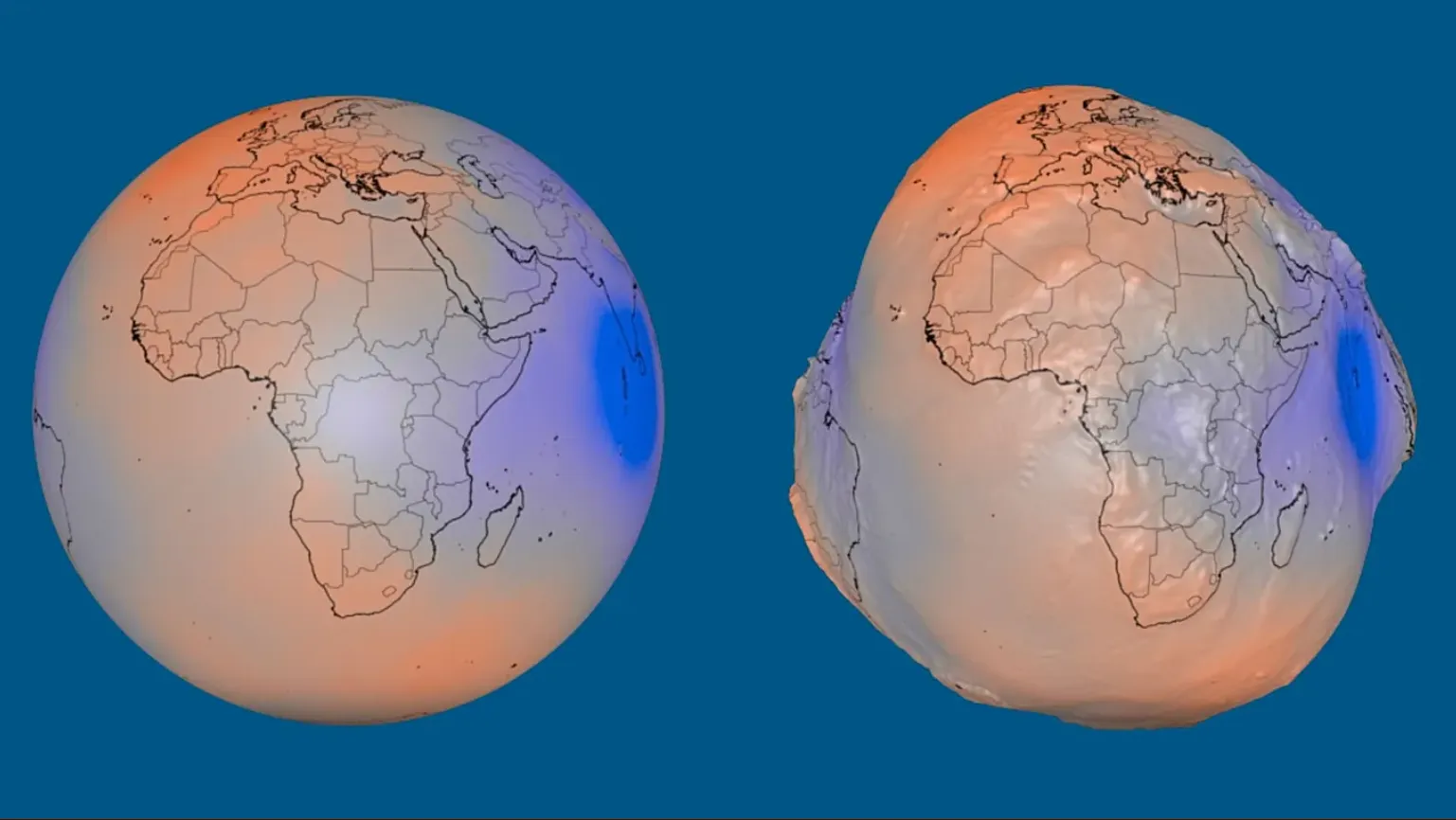
Gravity is influenced, in particular, by mountains, oceanic trenches, and variations in the density of material deep within the Earth. Where more mass is concentrated, gravity is stronger, so it slightly alters the level of the hypothetical ocean surface.
In regions with a weaker gravitational field, the geoid is, accordingly, located lower.
To make these small differences visible, NASA magnified them in the image by about 10,000 times. That is why the visualization resembles a lumpy potato.
In reality, however, the difference between the highest and lowest points of the geoid is only about 191 meters.
The highest point of the geoid is located near Iceland—about 85 meters above the conventional datum.
The lowest point is south of India—about 106 meters below it.
In this case, the datum is a smooth, slightly flattened mathematical model of the Earth that is used as the basis for measuring such deviations.
The visualization was created based on over a billion measurements collected by 19 satellites over a 15-year period.
The resulting data helps scientists study the Earth’s gravitational field and track changes associated with the movement of water, ice, and other masses on the planet.
The geoid has not only scientific but also practical significance. It is used in cartography, geodesy, and navigation, particularly for more accurately determining elevations and coordinates on the Earth’s surface.
Thus, NASA’s famous “potato-shaped Earth” is not a photograph of our planet’s actual shape, but a highly exaggerated model that allows us to see the invisible irregularities in Earth’s gravitational field.
Euronews reports on this.
Earlier, NASA released images of a crater on the Moon formed by the impact of the upper stage of a SpaceX Falcon rocket. The Lunar Reconnaissance Orbiter captured the impact site before and after the collision, according to ABC News Australia.
A photo of Mars taken by NASA’s Spirit rover back in 2007 is once again gaining popularity online. Users have noticed a dark silhouette that resembles a person walking across the surface of the Red Planet.


