Massive Russian attack on 26 February: map of missile and drone routes released

During the night of 26 February, the Russian Federation carried out a combined strike on the territory of Ukraine using missiles and attack drones.
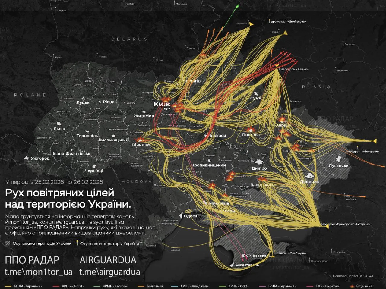
The Telegram channel “PPO Radar” published an approximate map showing the movement of aerial targets during the attack.
According to the monitoring resource, the main directions of the enemy attack were:
- Kharkiv and the Kharkiv region;
- Mykolaiv region;
- Vinnytsia and its suburbs;
- Zaporizhzhia;
- Kyiv and its suburbs, as well as the Kyiv region;
- Kryvyi Rih;
- Frontline areas of the Donetsk region;
- Poltava.
The channel reports that among the possible targets during the night-time attack were critical and military infrastructure facilities, including:
- Electrical substations;
- An aerodrome;
- Combined heat and power plants (CHPs) and thermal power plants (TPPs);
- A defence-industrial complex facility.
Information regarding the precise consequences of the strikes and the extent of damage to the facilities is being clarified by official authorities.
It should be recalled that on the night of 26 February, Russia carried out another large-scale aerial attack on Ukraine, using strike drones, ballistic and cruise missiles. In a number of regions, residential buildings were destroyed, fires broke out, and infrastructure was damaged.
During the same night, Russian forces launched a combined attack on Kharkiv using strike drones and ballistic missiles. A direct hit on a multi-storey residential building was recorded in the city, with a gas pipeline and overhead contact lines damaged and fires breaking out.
