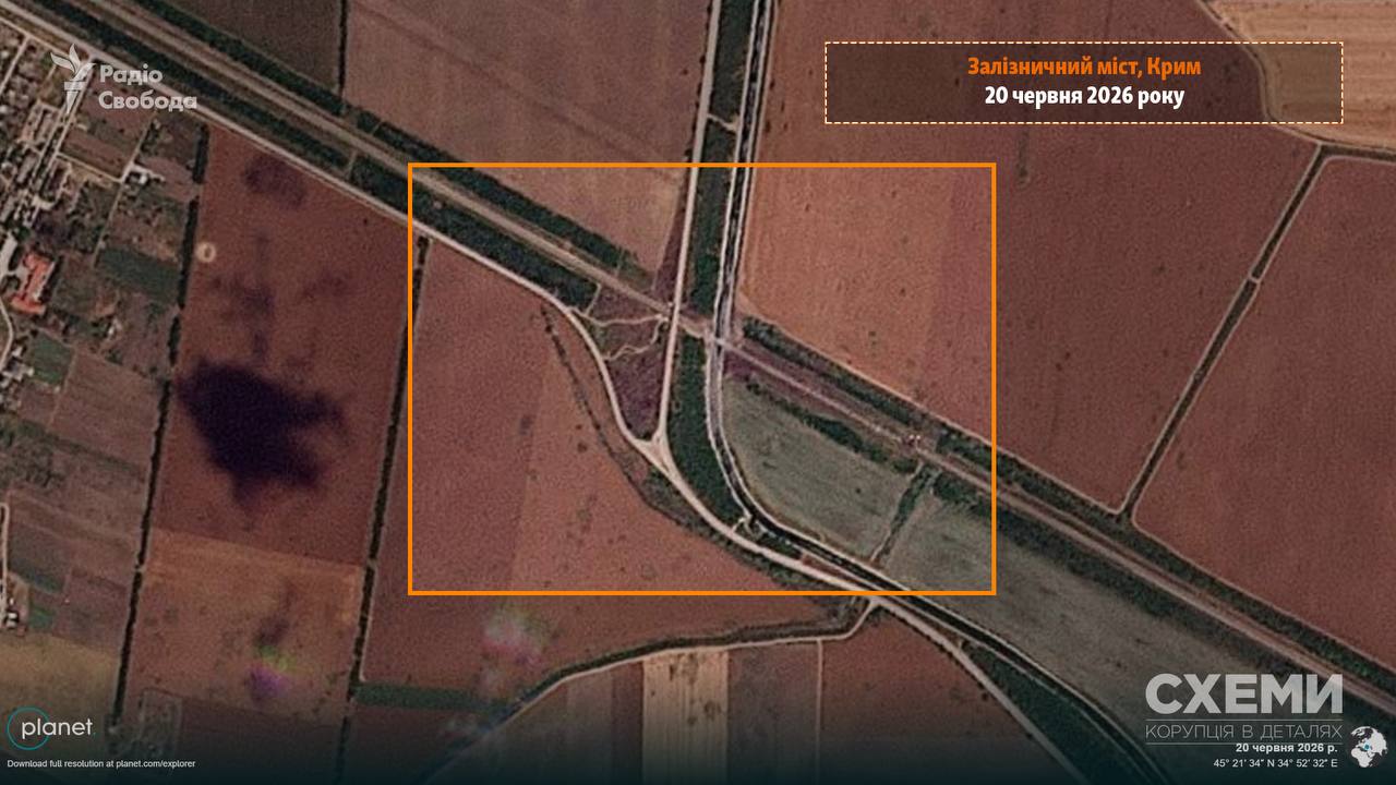
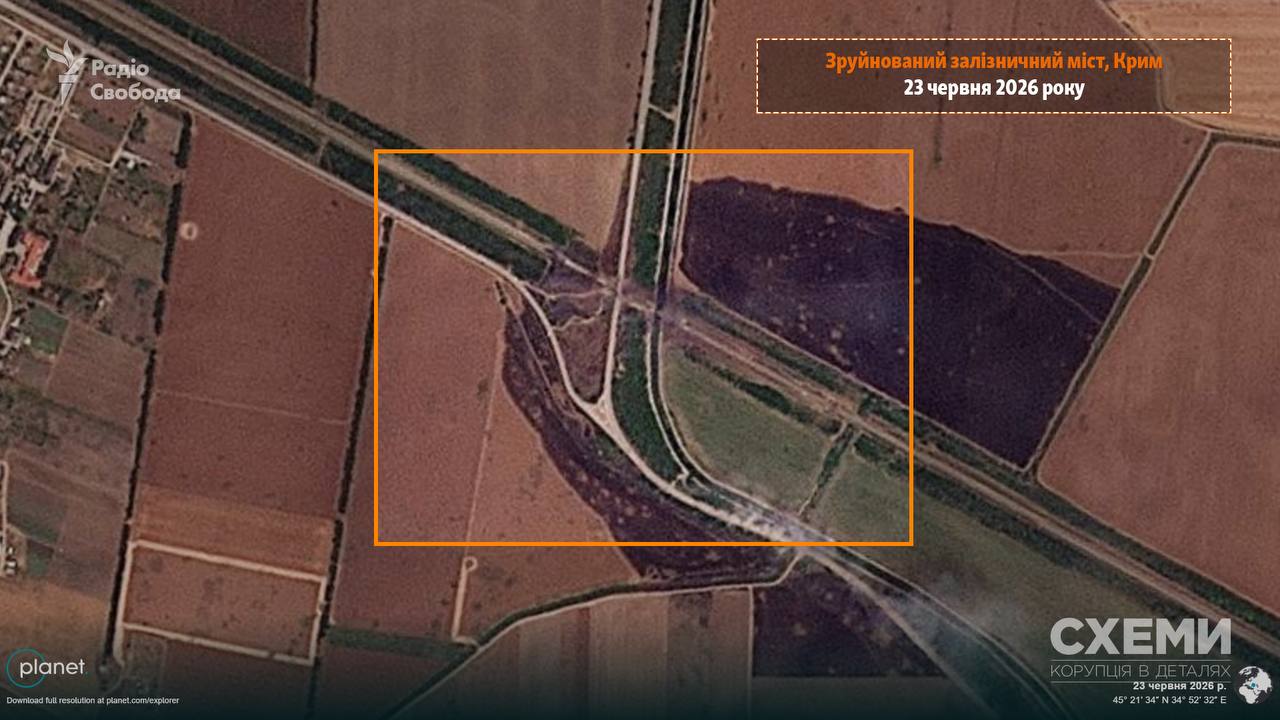
Satellite photos of the destroyed bridge over the North Crimean Canal have been released

The first satellite images confirming the success of a special operation by the Ukrainian military in the temporarily occupied Crimea have appeared online. Journalists have released satellite images showing significant damage to a strategic railway bridge across the North Crimean Canal, which was struck by Special Operations Forces (SOF) troops.
Satellite images from Planet Labs, taken on June 23, clearly show serious damage to the structures of the railway bridge near the village of Rozdolne. The resulting damage makes it completely impossible to continue using the bridge for rail traffic. According to available information, systematic fire attacks on this logistics facility continued for two days—June 22 and 23.
The Special Operations Forces Command notes that the destroyed bridge served as a strategic military-logistical artery for the Russian occupation forces. The invaders used the railway branch as part of a single transport corridor for the regular movement of critically important cargo. Disabling this hub will force the Russian command to seek significantly longer detours, which will substantially slow the delivery of ammunition, fuel, and personnel to the front lines, and will also create favorable conditions for further counteroffensive operations by the Armed Forces of Ukraine in the southern sector.
This was reported by the “Schemes” project (Radio Free Europe/Radio Liberty).
Special Operations Forces have released footage of the destruction of a railway bridge across the North Crimean Canal near the village of Rozdolne in the temporarily occupied Crimea.
As a reminder, the Ukrainian Armed Forces have managed to completely halt the supply of food, fuel, and ammunition to Russian units on the Kinburn Spit.


