
Satellites have detected changes in the Earth's crust following the earthquakes in Venezuela
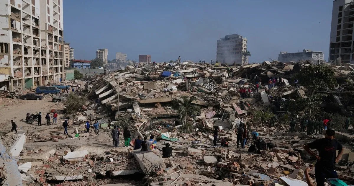
On July 2, the European Space Agency released satellite images showing how two powerful earthquakes in Venezuela altered the Earth’s crust. The images allow us to assess the extent of surface deformation following the natural disaster.
The images were created based on observations from the Sentinel-1 satellites, which are part of the European Copernicus program. These satellites do not take conventional photographs—they use radar to “illuminate” the Earth’s surface and measure the time it takes for the signal to return to the sensor.
By comparing two measurements of the same area taken on different dates, scientists can determine whether the Earth’s surface has shifted, even if these changes are imperceptible to the naked eye.
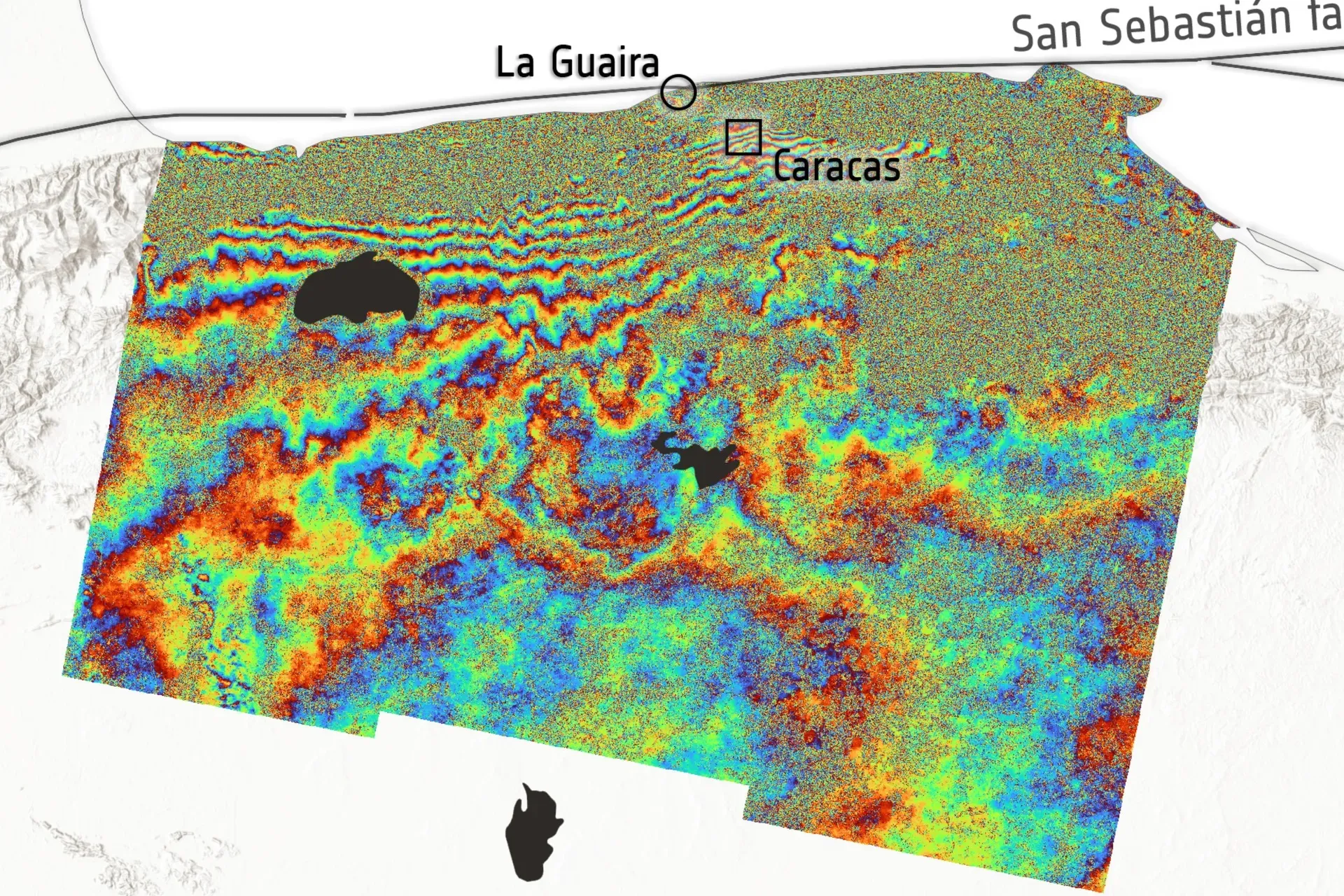
To create the map, experts compared data collected on June 18—one week before the earthquakes—with data from June 25, the day after two earthquakes measuring 7.2 and 7.5 on the Richter scale. This allowed them to create a so-called interferogram, which shows the extent to which the Earth’s surface was deformed following the natural disaster.
The map clearly shows repeating colored bands stretching horizontally across the northern part.
“Each complete color cycle—blue, green, yellow, red, and blue again—corresponds to a fixed increase in the distance between the satellite and the Earth’s surface. The more such cycles there are between two areas, the greater the total ground displacement,” ESA explained.
The pattern of colored bands in the northern part of the map corresponds to the area around the epicenter of the earthquakes, where the greatest deformation occurred. The bands roughly follow the direction of the San Sebastián Fault—one of the major tectonic structures in northern Venezuela. According to ESA estimates, the ground displacement in this area was about 30 centimeters.
However, this does not mean that the ground rose or sank by exactly 30 centimeters. During earthquakes, the surface can shift upward, downward, sideways, or in several directions at once. The interferogram shows the total magnitude of the change, but not its direction. To determine the direction, additional types of satellite imagery and ground-based geodetic surveys are required.
Conducting such studies in the near future will be difficult, as Venezuelan authorities and international partners are focused on disaster relief, rescue operations, and addressing the humanitarian crisis caused by the destruction of buildings and infrastructure.
Space agencies and data processing centers around the world have already joined forces to share information that will aid in the recovery efforts. In particular, NASA has activated its disaster response coordination system to identify the most dangerous areas, according to Wired.
Earthquakes in Venezuela have claimed the lives of nearly 2,000 people — DW.
Two powerful earthquakes have rocked Venezuela; there may be tens of thousands of victims
People deported from the U.S. are missing in Venezuela following a devastating earthquake — CNN


