November 6, 2026 — The Kyiv Metro Turns 66: History and Interesting Facts
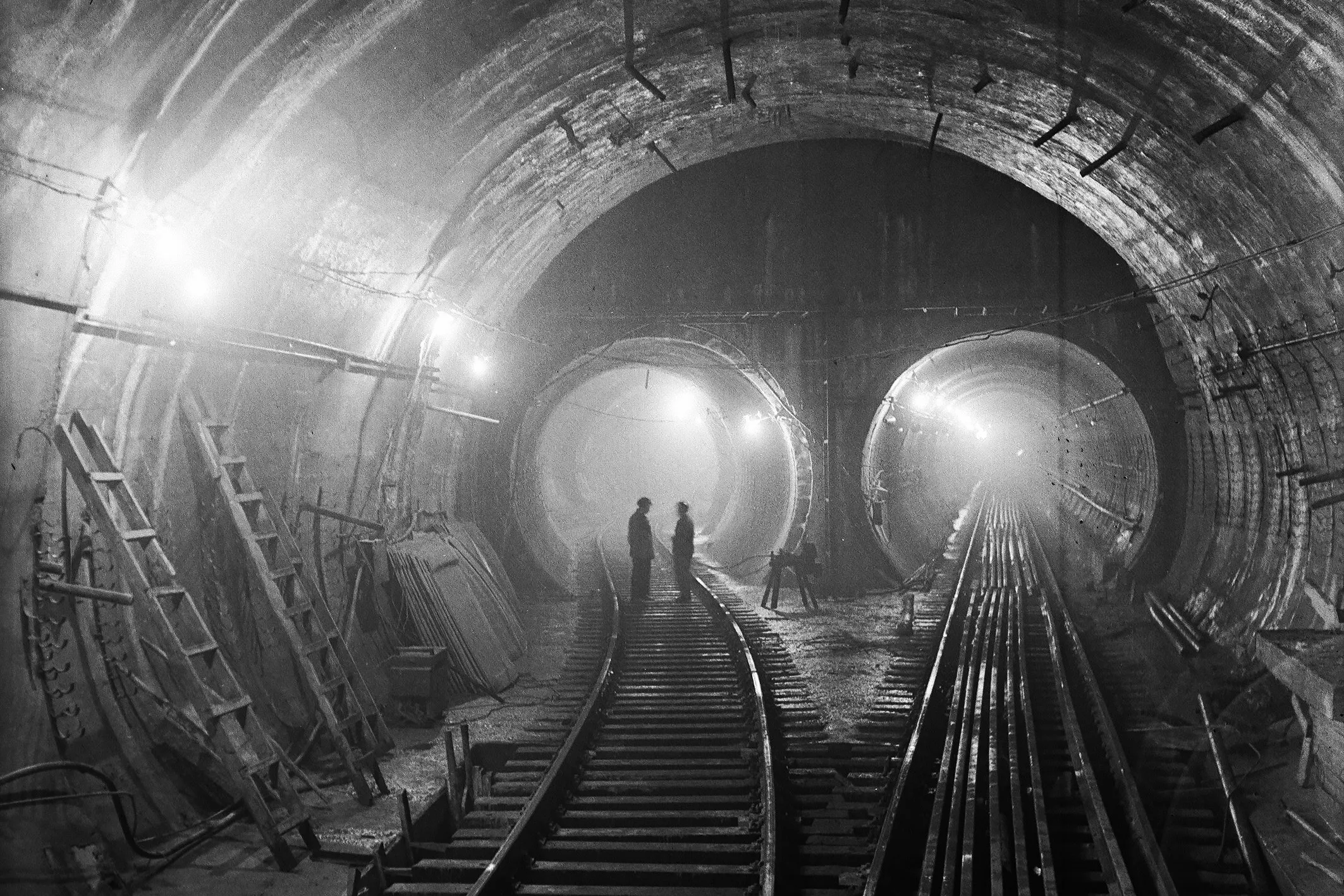
On November 6, 1960, the first phase of the metro—Ukraine’s first metro system—was launched in Kyiv. At that time, trains began running between five stations on the Sviatoshynsko-Brovarska Line, and the total length of the section was 5.2 kilometers. Since then, the metro has become one of the capital’s main modes of public transportation, and its history has become part of Kyiv’s history itself.
Ukraine’s first metro system opened on November 6, 1960, in Kyiv. The 66th anniversary of this event will be marked in 2026. That is why, every year in early November, people commemorate the launch of the first metro line and the people who worked on its construction. It is neither a national holiday nor an official day off, but a memorable date in the history of Ukrainian transportation and the capital.

At the time of its opening, the metro had five stations: “Vokzalna,” “Universytet,” “Khreshchatyk,” “Arsenalna,” and “Dnipro.” They connected the train station with the city center and the Dnipro district. The first section was short by today’s standards, but for Kyiv, it was a major transportation milestone. The city gained a fast mode of transportation that was not dependent on traffic jams or crossing congested streets.

The first passenger train departed from the “Khreshchatyk” station on November 6, 1960. The grand opening was attended by representatives of the Soviet leadership, including Mykola Pidhorny, First Secretary of the Central Committee of the Communist Party of Ukraine. Historical photographs capture moments from the ribbon-cutting ceremony at the Khreshchatyk station. Since then, this date has served as the starting point for the history of the metro in Ukraine.
How the Idea to Build a Metro in Kyiv Came About
The idea of an underground transit system in Kyiv emerged long before the opening of the first station. As early as 1884, members of the city council discussed the possibility of building an underground railway. One of the proposed routes was to connect Poshtova Square with Bessarabka, where a new railway station was planned. However, the project was not supported at the time, and the city continued to develop surface transportation.

At the end of the 19th century, Kyiv began actively expanding its tram network. In 1891, a horse-drawn tramway—known as a “konka”—was launched here. Due to the city’s complex topography, it was later replaced by electric trams in certain sections. Kyiv became one of the first cities in the region to introduce this form of transportation. However, trams could not fully solve the problem of connectivity between neighborhoods, especially given the city’s complex geography and its growing population.

The idea of an underground railway was revisited in 1916 and 1918. But at that time, the country was experiencing political upheaval, wars, and economic hardships, so it was not possible to implement this large-scale project. More realistic plans began to emerge in the 1930s, when the city was growing rapidly and traffic volume was increasing. In 1936, the Presidium of the Kyiv City Council approved a project for an underground railway loop approximately 40 kilometers long. It was intended to connect various districts of Kyiv and its suburbs, but full-scale construction never got off the ground.

In the 1930s, work also began on building tunnels under the Dnipro River. The plan was to create underwater crossings that would provide rail service between the river’s banks. About 20,000 people were involved in the work. However, in February 1941, serious problems arose during construction, and with the outbreak of the German-Soviet War, work was halted. After the war, work resumed, but in 1949 the project was deemed impractical and was permanently abandoned. Instead, the city focused on building a full-fledged metro system.
How the First Metro Line Was Built
Postwar Kyiv needed a new transportation system. The city was recovering from the destruction of World War II, the population was growing, and the distances between residential areas and the city center were becoming increasingly noticeable. In 1949, preparations for the construction of the metro began. The main route chosen ran from Sviatoshyn through the city center to Darnytsia, which was intended to connect the western and eastern parts of the city.

Construction of the first phase was challenging due to the unique topography of Kyiv. The city is located on both banks of the Dnipro River, and there are significant elevation differences beneath the central part of the city. Engineers had to take into account the soil conditions, slopes, and the proximity of the river. Some of the tunnels were dug deep underground, while open-cut construction methods were used for other sections.

One of the most challenging projects was the “Arsenalska” station. It was built at a great depth due to the unique topography of the Dnipro’s right bank. As a result, the platform ended up approximately 105.5 meters underground. That is why “Arsenalska” is often called the deepest metro station in the world. To reach it from the surface, passengers must take two escalators.
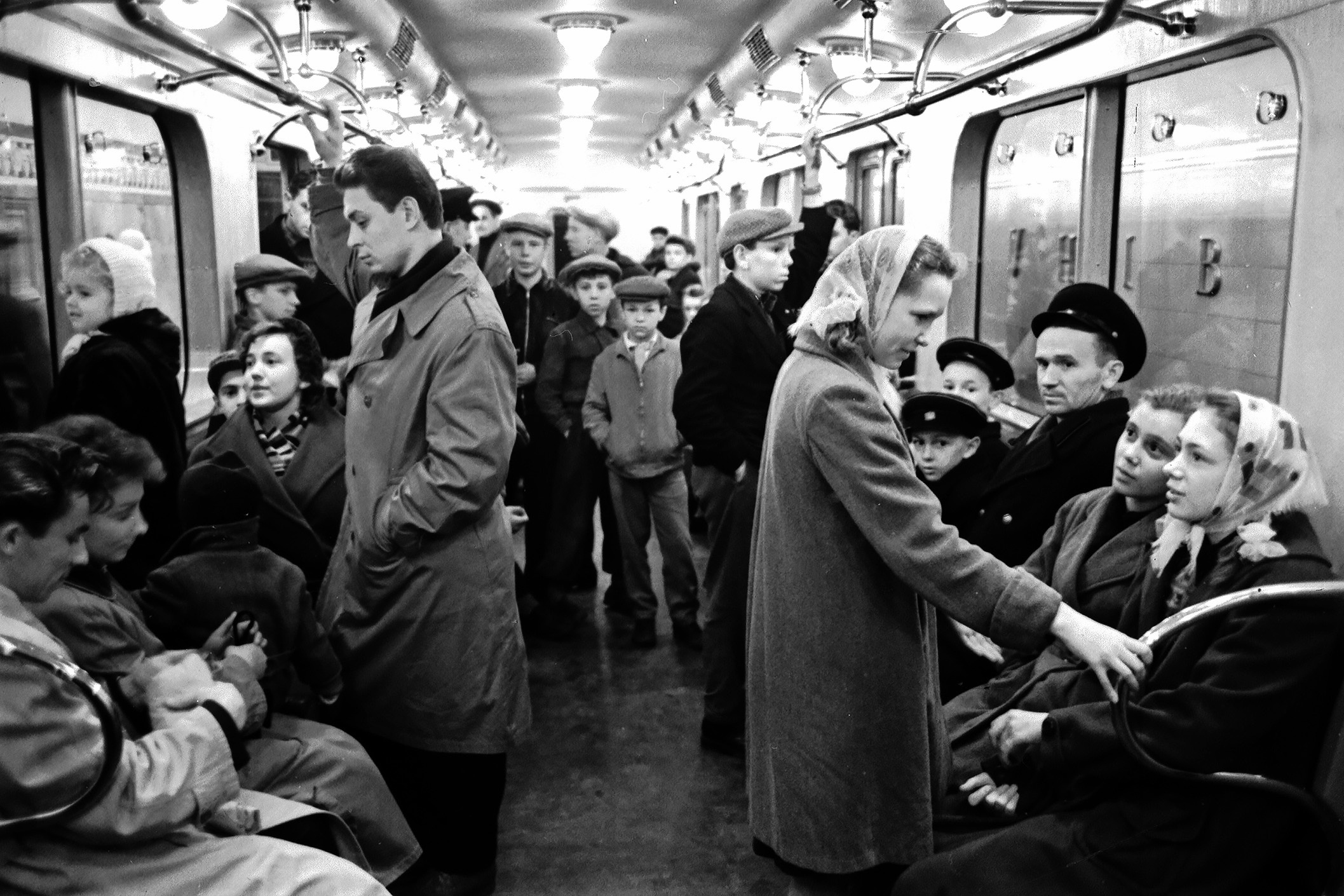
Another unique aspect of the construction was that the subway cars initially could not simply drive into the underground system. To deliver them, a temporary depot was set up near the Dnipro River. The cars were transported by rail to Darnytsia, then transferred to special carts and delivered along tram tracks to the “Dnipro” station. There, they were raised to platform level using a special device and guided into the tunnel. This unusual method of transportation was necessary until the metro had a full connection to other railroad tracks. By October 1960, the main work on the first phase was already nearing completion. Construction workers were preparing the stations, tunnels, equipment, and rolling stock for launch. And on November 6, the first passengers were able to use this new mode of transportation. For Kyiv, this marked the beginning of a major transformation in transportation.
What Were the First Stations of the Kyiv Metro Like?
The first five stations were significant not only for transportation but also for architecture. They were designed in a style characteristic of mid-20th-century Soviet architecture: featuring marble, granite, decorative elements, and grand halls. Each station had its own distinctive features designed to highlight its place in the urban landscape.

“Vokzalna” became an important hub for passengers arriving in Kyiv by train. It provided convenient access between the station and the city center. “Universytet” was named for its proximity to Taras Shevchenko National University of Kyiv. Its interior is distinguished by red marble and busts of prominent figures in science and culture.

“Khreshchatyk” was opened in the very heart of the capital. The station quickly became one of the most important in the system, as it provided access to the city’s main street and central institutions. “Arsenalna” is known for its record-breaking depth. And the “Dnipro” station became unique thanks to its location above the river and the open design of its platform. From there, passengers could see the Dnipro River, the bridges, and the surrounding scenery. These stations remain part of Kyiv’s historic architecture to this day. They serve as a reminder of what the city was like in the early 1960s and how modern public transportation was envisioned back then. The first stations did more than just connect several neighborhoods—they laid the foundation for a system that would eventually cover a significant portion of the capital.
How the Kyiv Metro Developed After Its Opening
After the launch of the first phase, the metro began to expand rapidly. As early as 1963, a new section with three stations was opened: “Polytechnic Institute,” “Bolshevik Plant” (now “Shulyavska”), and “Brestskaya.” This made it possible to extend the line westward and serve new areas of the city.

A major milestone was the opening of the metro bridge across the Dnipro River on November 5, 1965. Thanks to this bridge, the Sviatoshynsko-Brovarska Line was able to cross to the left bank. The route was extended via the “Hydropark” station to Darnytsia, and later further east. This became particularly important for residents of the left-bank districts, for whom it had previously been more difficult to reach the city center.
Over the next few years, the metro continued to expand. By 1971, the line had been extended westward to the “Svyatoshyn” station and eastward to the “Komsomolska” station, now known as “Chernihivska.” The total length of the route then reached approximately 18 kilometers. Thus, the first short section transformed into a full-fledged transportation artery connecting different parts of the capital. Later, two more lines appeared in Kyiv—the Kurenivsko-Chervonoarmiyska Line (now the Obolonsko-Teremkivska Line) and the Syretsko-Pecherska Line. The metro gradually expanded to cover new residential neighborhoods, business districts, educational institutions, and transportation hubs. Today, the Kyiv Metro has three lines and is one of the city’s main forms of public transportation.
Interesting Facts About Ukraine’s First Metro
The history of the Kyiv Metro is full of details that may surprise even those who ride the subway every day.
- “Arsenalska” is one of the deepest stations in the world. Its platform is located at a depth of approximately 105.5 meters. This is due to the topography of the right bank of the Dnipro River. Due to the considerable depth, passengers descend to the platform via two escalators.
- The first line opened with just five stations. Today, this may seem like a short route, but at the time, it was a major step forward in the development of public transportation. The first section connected the train station, the city center, and Dnipro.
- The subway cars were delivered to the metro in an unusual way. Before full-scale service began, they were brought to Darnytsia and then transported to the “Dnipro” station via tram tracks using special carts. There, the cars were lifted to platform level.
- The “Dnipro” station has an unusual location. It was built over the river rather than deep underground. Its platform and overpass became one of the most distinctive features of the first line.
- The metro opened on November 6. The date was chosen during the Soviet era, when November 7 marked the anniversary of the October Revolution. The metro’s grand opening was timed to coincide with this national holiday.
- The first stations became architectural landmarks. They were designed using marble, granite, decorative lighting, and other materials. Some of the original architectural features have survived to this day.
How the Kyiv Metro’s anniversary is celebrated
November 6 does not have any specific nationwide holiday traditions. It is primarily a historical date commemorated in the context of Kyiv’s development and Ukrainian public transportation. To mark the anniversary of the metro’s opening, city agencies, transportation companies, and museums can prepare themed materials, archival photographs, guided tours, or stories about the metro’s operations. For passengers, it’s also an opportunity to see familiar stations in a new light. For example, they can take a closer look at the architecture of “University,” the unusual location of “Dnipro,” or the depth of “Arsenalna.” Each station has its own story tied to the city’s development and the engineering solutions of its time.
Another way to mark this date is to look through old photographs, read the memoirs of the first passengers, or learn more about the people who built the metro. After all, behind every familiar route lies the immense work of engineers, architects, builders, and transit workers. Their efforts gave Kyiv a system without which it’s hard to imagine daily life in the capital today.
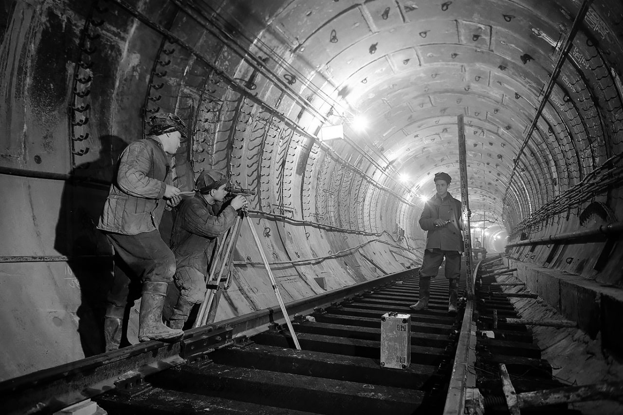
Over more than six decades, the metro has undergone expansion, modernization, station name changes, and difficult trials. During the full-scale war, its stations also served as shelters for city residents during air raid alerts. Therefore, the history of the Kyiv Metro is not only a history of transportation but also a history of how the city has changed and adapted to new challenges.